Drone Deployment Services can provide aerial images of farm land real estate, analyze crop health, create custom prescription and thermal imaging. In addition, we can provide images of planted acreage, barn roof/silo inspection, stream feed changes/irrigation inspections, lost livestock, we offer versatility to meet many of our farmer’s needs.
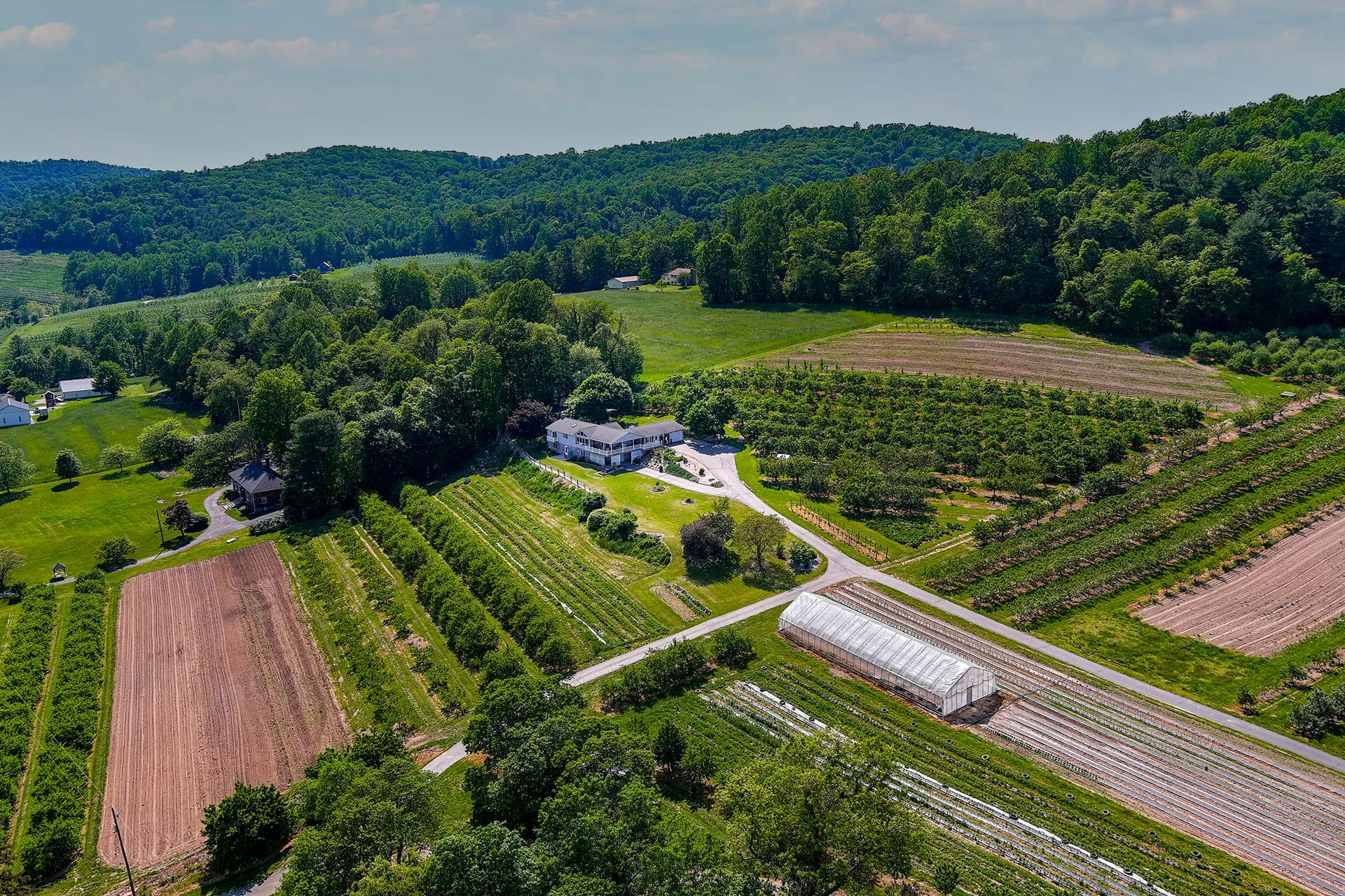
Farm Land Real Estate
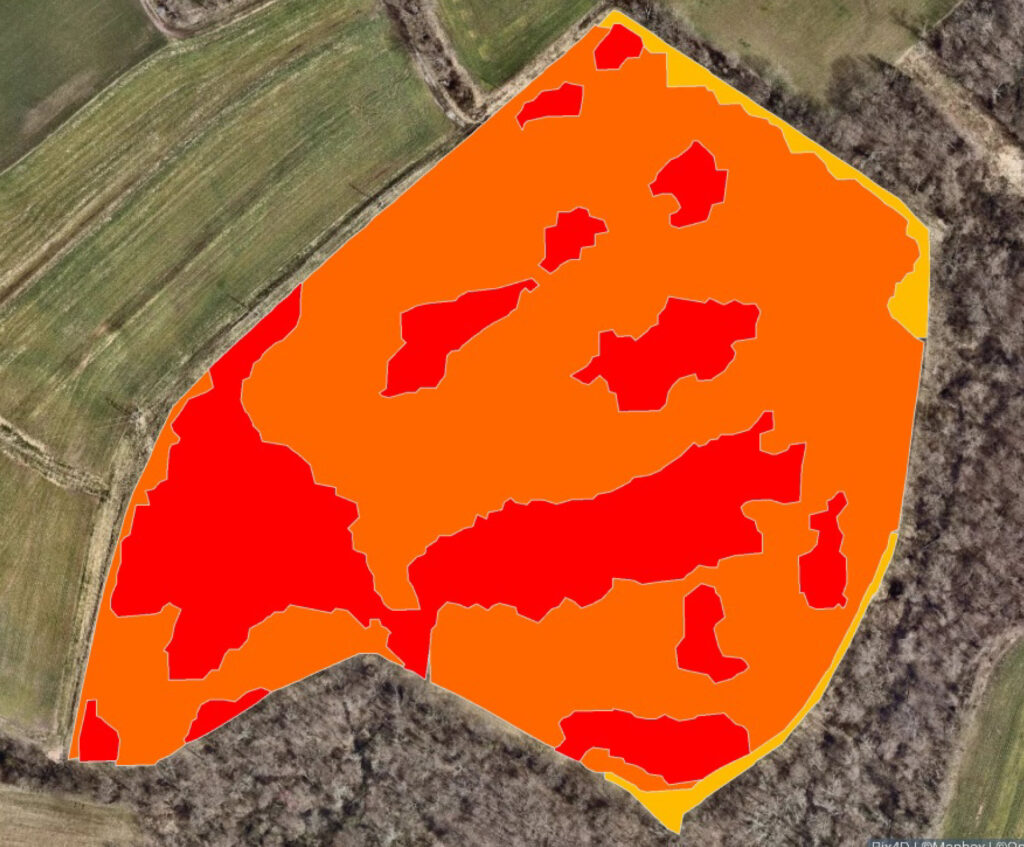
Analyze Crop Health
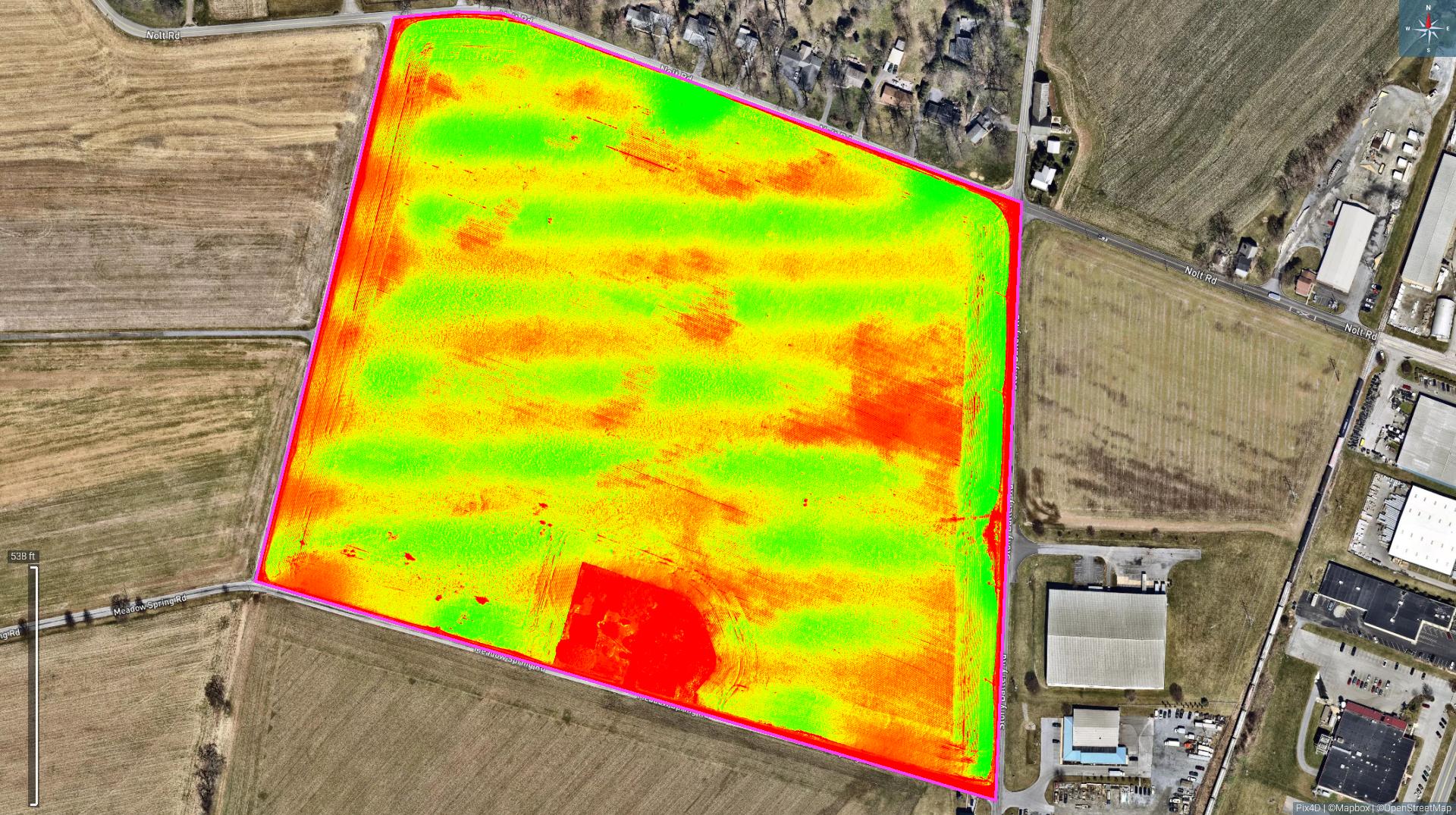
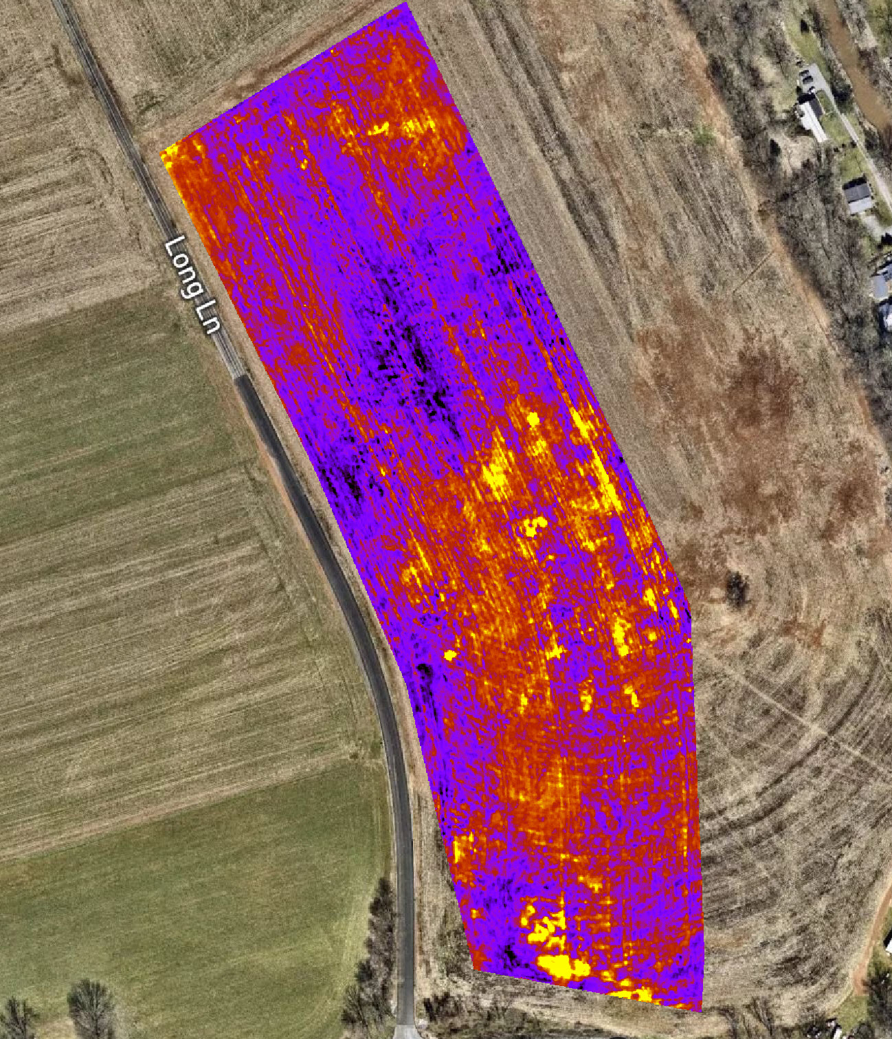
Soil Moisture Analysis
Farm Land Real Estate
Crop Health Analysis/Custom Prescription/Crop Scouting
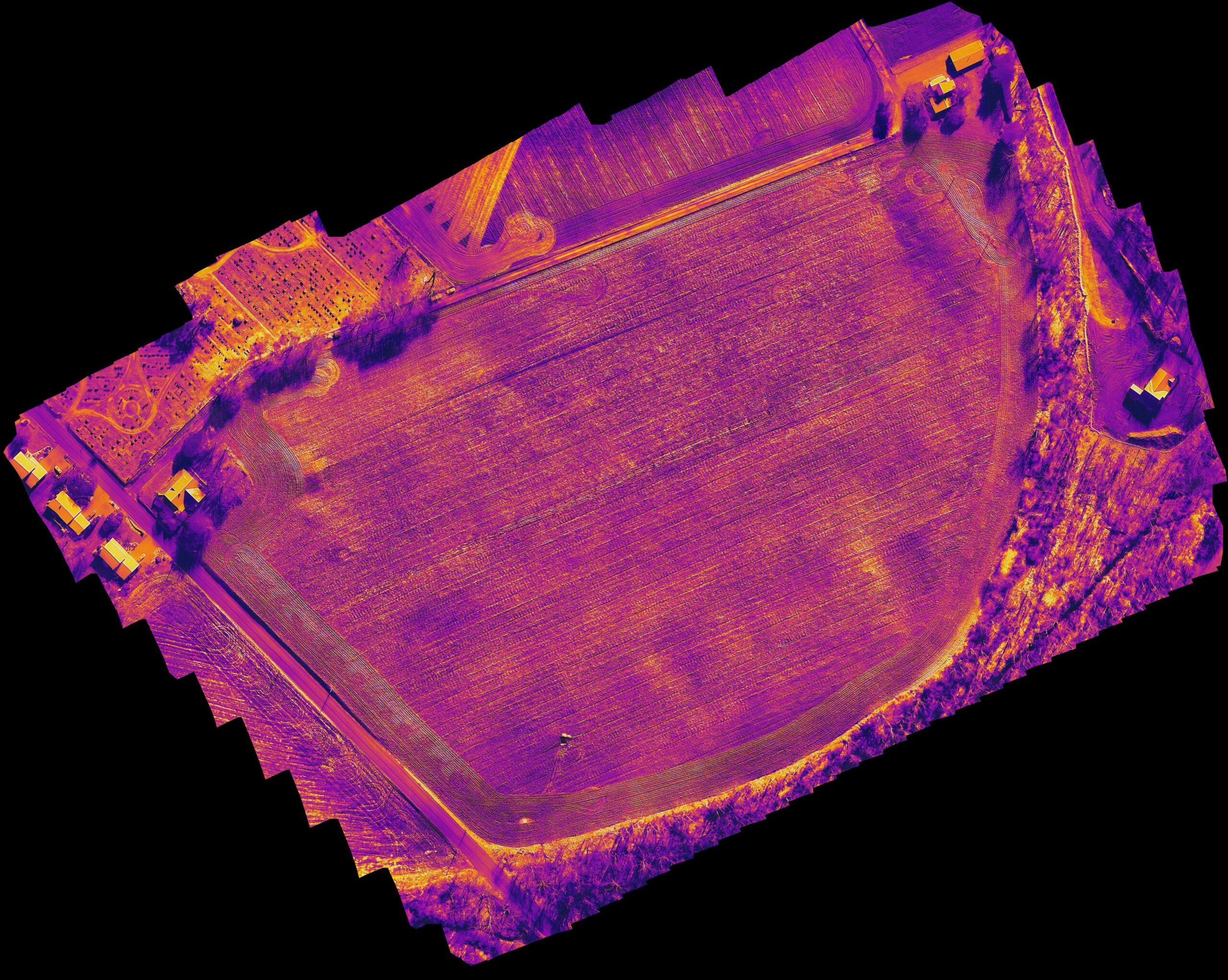
Thermal Imaging for AG
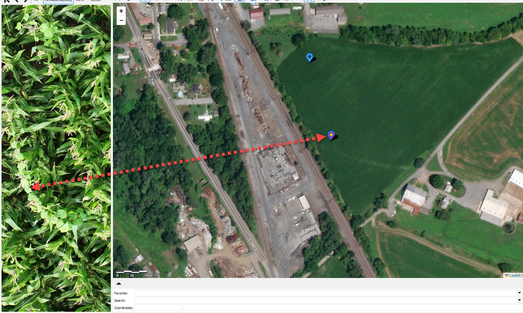
Thermal images taken by a drone can help detect changes in vegetation temperature revealing crop disease, pests or other problems and allow you to respond timelier with solutions or preventative measures. Another use for thermal imaging is to aid in detecting drainage, irrigation problems, leaks or clogs in equipment by revealing the variations in ground temperature. If your land is powered by solar panels, it may be time for an inspection to ensure all cells are working efficiently. Thermal imaging can also be used to scout and/or search for rogue livestock.
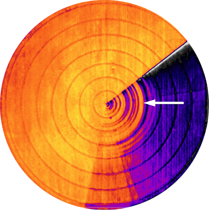
Arrow indicates a hot spot during irrigation, resulting from block nozzle.
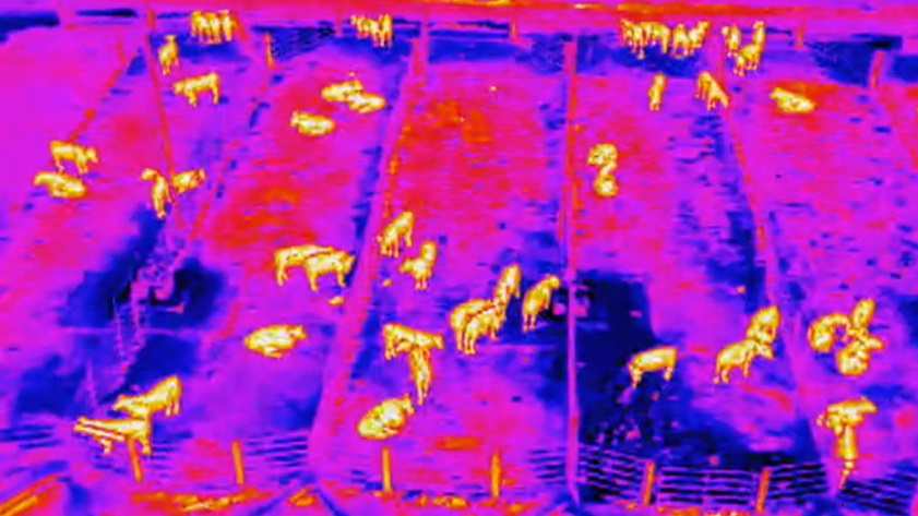
Thermal image of livestock.
Contact Information
Drone Deployment Services is truly interested in providing solutions to farmers using drone technology. We want to hear from you regarding alternative solutions that will provide value to the farming industry.