
Construction Site Progression
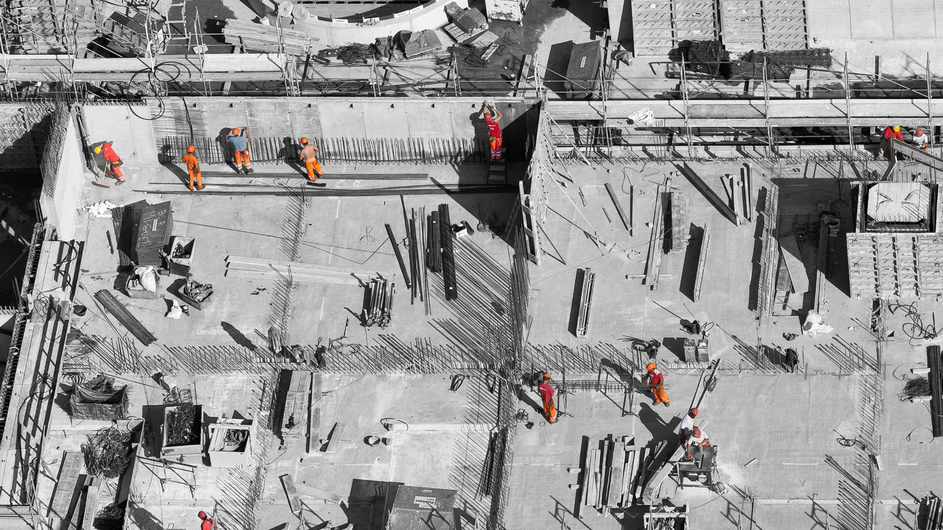
Keeping track of expensive assets and finding mistakes early in any phase of the construction process can save time and money. Drone Deployment Services can provide aerial stills, video, 2D/3D modeling/mapping and digital elevation modeling on a weekly or monthly schedule. DDS uses the latest in technology to bring clients state of the art imagery of their construction sites. The images and data collected can be used in a variety of ways to keep your construction on schedule. Drone construction progression allows you the ability to simultaneously monitor multiple construction projects without physically being on site. Several types of data collection tools are available, each providing a unique visual and beneficial details specific to each job. See which tool or combination of tools is right for your construction project.

Use the slider to reveal full image of site progress from one week to the next or month to month. Custom scheduling can be made to best suit your needs.
Construction Site 2D Modeling
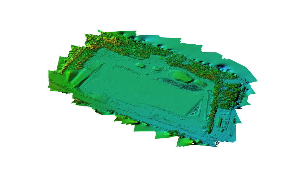
Construction Site 3D Modeling
While a regular flat map of your construction site is helpful, imagine the benefits of having a map in 3D!
Looking to overlay construction progress with blueprints or need accurate measurements of distances, surfaces, volume and elevations?
Drone flight paths for 3D modeling can be created to provide consistent analysis of the construction project and catch mistakes early in any phase of construction. DDS can deliver detailed files (OBJ or Tiff) to the engineering team for a complete analysis of the construction site.
Interactive 360 Panorama
Video
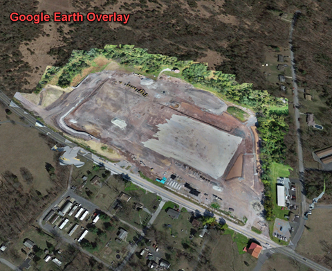
Google Earth Overlay
2D Orthomoasic images can be overlaid on Google Earth to track real-time progress of your construction site.